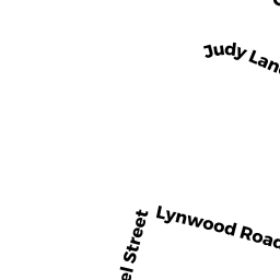
56 LYNWOOD RD
Owner Information
REYES DENNIS J
56 LYNWOOD RD
EAST LONGMEADOW, MA 01028


Property Details
56 LYNWOOD RD is classified as a Single Family Residential (Cape).
The primary structure on this property was built in 1952. There is 1,602ft2 of residential/living space within this property.
56 LYNWOOD RD is valued at $184,400. The land is valued at $62,300 and the structures are valued at $120,500. There is an additional valuation of $1,600 on this property.
This property is in Zone RA. Confirm with local Zoning Board authorities to ensure there are no overlays or other easements on this property.
The most recent deed for 56 LYNWOOD RD is recorded at the local registrar in Book 20872, Page 563. 56 LYNWOOD RD was last sold on Tuesday, September 15, 2015 for $171,900.
Assessment data from fiscal year 2019.
Flood Data
According to the FEMA National Flood Hazard Layer, this property does not appear to be in a flood zone. It may also be in an area not yet reviewed. Nonetheless, confirm this information prior to taking any action.
To view the flood hazards around this property, create a FEMA "Firmette" Map of the area around 56 LYNWOOD RD.
Broadband Internet Providers
| Provider | Type | Bandwidth (mbps) | |
|---|---|---|---|
| VSAT Systems, LLC. | Satellite | 2 | 1 |
| GCI Communication Corp. | Satellite | 0 | 0 |
| Viasat Inc | Satellite | 100 | 3 |
| HughesNet | Satellite | 25 | 3 |
| Charter Communications Inc | Cable | 940 | 35 |
| Verizon New England Inc. | DSL | 15 | 1 |
Broadband service provider data from December 2020.
Adjacent Properties
- 92 PINE GROVE CR
Single Family Residential owned by PLEASANT TED F - 30 JUDY LN
Single Family Residential owned by RALEIGH WILLIAM T IV - 88 PINE GROVE CR
Single Family Residential owned by KNIGHT TIMOTHY W - 399 ELM ST
Single Family Residential owned by LAWOR THOMAS - 50 LYNWOOD RD
Single Family Residential owned by DRAPER ROBERT E